OUR RESEARCH
The 4D OCEANS Lab looks at advancing our understanding of seafloor spatial heterogeneity, distributions of benthic communities, how habitats may respond to different human-induced and natural stressors, and how scale (extent and resolution) affects our ability to detect and monitor change. We employ a range of technologies (AUVs, ROVs, sonars, photogrammetry) to provide high-resolution maps from which quantitative insights regarding resource location, infrastructure condition, geological hazards, local oceanographic processes or effectiveness of conservation measures can be drawn.
Specific aspect of our research include:
- The development, optimization, and implementation of a multi-scale mapping framework for robust monitoring of both economically- and ecologically- valuable habitats.
- The implementation of automated classification techniques and predictive models as a cost-saving tool to target areas of interest, minimize environmental impacts, and quantitatively monitor change.
- The production of maps that represent the marine environment in three dimensions; integrating the surface, water column, and seabed to better characterize ocean heterogeneity.
PROJECTS
Placentia Bay, NL
Placentia Bay has been recognised as an important coastal area in the province of Newfoundland and Labrador (NL), both for its socio-economic and ecological importance. It supports a traditional commercial and recreational fishery, an aquaculture industry, a growing oil and gas/shipping industry. Due to its ecological and socio-economic value in the NL province, Placentia Bay was selected as the focus region for a new Government of Canada Coastal Environment Baseline Program, helping establish an environmental baseline that could be used to assess future human impacts and environmental changes.
While specific species have been identified as being of particular importance in Placentia Bay, the more general marine habitat that supports marine ecosystems is key when trying to ensure long-term ecosystem integrity and can be a good indicator of future potential changes in this region. This project aims at improving our understanding of the current status of coastal habitats in Placentia Bay using different approaches. First, multibeam bathymetry will be collected at seven key sites, covering a range of sites of known ecological importance in Placentia Bay. Second, ground truthing data will be collected at those same sites in order to map benthic species distribution and produce benthic habitat maps. Third, high-resolution aerial drone imagery of eelgrass will be collected at several sites in Placentia Bay. Together, those activities will help collect baseline data characterizing both coastal habitats and the distribution of key species in the bay.
Holyrood, NL
To understand environmental fluctuations that may be outside the normal range of variation, we need long-term datasets. Currently, our oceans are facing significant changes (e.g. increased human activities, climate change and ocean acidification) which may alter the functioning of our ecosystems. However, for many of these changes, we do not possess sufficient information to characterize their baseline state. This research program will characterize the temporal and spatial environmental variables responsible for spatio-temporal patterns of large fish and invertebrate species using a seafloor cabled-observatory time-lapse camera as well as video surveys of the surrounding area. Particular focus will be given to monitoring responses to the spring phytoplankton bloom to understand how changes in the timing of this event, an expected impact from climate change, may affect seafloor communities, including the economically important snow crab. Collaborations with Fisheries and Ocean Canada (DFO), and Ocean Network Canada (ONC) researchers will ensure that research results improve our ability to understand shifting ecosystems and can be disseminated broadly. Early detection of change will be key and by understanding the mechanisms driving species responses to environmental change, this research program will enable us to assess ecosystem resilience and predict how current trends may affect Canadian sub-Arctic communities.
Charlie-Gibbs Fracture Zone
The deep sea is one of the most extreme environments on our planet. Low temperatures, tremendously high pressure, and the long distance from shore create ecosystems that are about as remote as they can get. Areas previously explored are rarely re-visited, mainly due to the high costs of offshore expeditions. The deep sea still poses many mysteries, from the basic biology and ecology of organisms, to the geology and geomorphology of the seabed. The Charlie-Gibbs Fracture Zone (CGFZ), a double transform fault spanning the width of the North Atlantic Ocean, is no exception.
The CGFZ offsets the Mid Atlantic Ridge by almost 370km and influences the warmer waters of the North Atlantic current as well as the sub polar front, creating productive surface waters. This in turn creates a hotspot for charismatic megafauna like cetaceans and seabirds. Very little is known of the benthic ecology of this feature, primarily due to its remote location.
The TOSCA (Tectonic Ocean Spreading of the Charlie-Gibbs Fracture Zone) survey team set out in the summer of 2018 on Ireland’s research vessel, the Celtic Explorer to find out how the underwater mounds in-between the two faults of the CGFZ were formed. They steamed over 1,600km off the West coast of Ireland to reach this remote location of the North Atlantic. The Remotely Operated Vehicle, Holland I, was utilised to collect geological samples and HD video footage of the area. The team also mapped the seafloor using the multibeam echosounder on board the vessel.
Aside from the geological discoveries, the videos alone provide a unique glimpse into the benthic ecology of this remote region. Communities of Octocorals and sponges have been observed as well as numerous species of deep-sea fish, sharks and rays, revealing the complex ecosystems of the CGFZ. This project aims to use the observations from the ROV video to identify Vulnerable Marine Ecosystems (VMEs), measure the biodiversity, and determine which environmental factors are influencing the biological community composition. Findings from this project may help to inform future decision making on the protection status of this potentially biodiverse area in the middle of the North Atlantic Ocean.
Barkley Canyon, British Columbia
Submarine canyons harbour rich biodiversity owing to their complex geomorphology and hydrological regimes. They also exhibit large bathymetric gradients in temperature, oxygen, food supply, and sedimentation rates, making submarine canyons excellent case studies for adaptation and tolerance of marine organisms to ocean change. Barkley Canyon is a submarine canyon located off the west coast of Vancouver Island, British Columbia, ranging from 200m where the apex meets the upper slope, down to 2200m on the continental rise. Much of the canyon sits in the core of the Northeast Pacific (NEP) Oxygen Minimum Zone (OMZ), where oxygen concentrations are as low as 0.2 mL/L. Recent research has demonstrated a startling 15% overall decline in dissolved oxygen in the upper 3000m of the NEP over the past 60 years, faster than the global average, with concurrent deepening and shoaling of the OMZ’s hypoxic boundary. Furthermore, a recent marine heatwave in 2013-2015 (“The Blob”) wreaked havoc on the NEP, leading to mass die-offs of seabirds, range shifts and topicalization of zooplankton, fisheries closures, and an unprecedented harmful algal bloom. However, the effects of the warm blob on the benthic megafauna in the NEP is largely unknown.
Ocean Networks Canada’s NEPTUNE cabled observatory node at Barkley Canyon collects continuous, high-resolution environmental data and high-definition video at the seafloor from the upper slope (400m) to the Cascadia basin (2200m). We are utilizing instruments at the Upper Slope and in the Axis (1000m) of the canyon to study the effects of ocean change over time on benthic megafauna in and around Barkley Canyon. This work will provide insight into how regular environmental variation influence benthic megafauna over time, and the role of extreme climate events in structuring seafloor communities.
Qikiqtaaluk, (Baffin Island), Nunavut
Fjords are common geological features along our coasts which can host high habitat complexity owing to their varied topography, interaction with currents, and natural gradients in water column properties (e.g. temperature, salinity, oxygenation). Fjords can also host deep-water species, many of which are slow growing taxa particularly vulnerable to anthropogenic influences, and whose location in coastal fjords can bring them in closer contact to human activities.
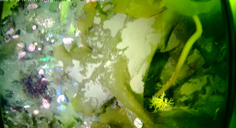
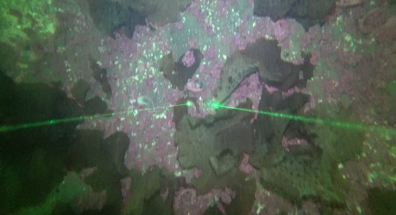
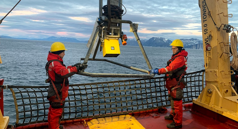
In 2021, 9 drop-camera sites were visited in Southwind fjord and 13 sites in Pangnirtung fjord as part of a CCGS Amundsen expedition. The underwater camera work was carried out in order to ground-truth the bathymetry and backscatter data previously collected for this area. The sites in Southwind fjord were characterized mainly by soft sediment and ophiuroids, while the ones in Pangnirtung fjord were mainly composed of crinoids and sponges on pebbles overlying soft sediment. Soft corals were occasionally observed in both fjords.
This biological data will now be combined to bathymetry and backscatter layers from multibeam sonar previously collected by the Geological Survey of Canada and ArcticNet to predict species assemblages and diversity for the full extent of these fjords.
Nuliajuk sailing Kangiqturuluk (Pangnirtung Fjord)
-Natural Resources Canada 2019
 |  |  |  |  |  |  |  |
|---|---|---|---|---|---|---|---|
 |  |  |  |  |  |  |  |
 |  |  |  |  |  |  |  |
 |  |  |  |  |  |  |  |
 |  |  |  |  |  |  |  |
 |  |  |  |  |  |  |  |
 |  |  |  |  |  |  |  |
 |  |  |  |  |  |  |  |
 |  |  |  |  |  |  |  |
 |  |  |  |  |  |  |  |
 |  |  |  |  |  |  |  |
 |  |  |  |  |  |  |  |
 |  |  |  |  |


